
Radio astronomy has always been governed by a stubborn compromise: a telescope can survey a vast region of sky, or it can inspect a smaller region with exceptional sharpness. The latest wide-area Very Large Array survey direction challenges that old assumption. Its significance is not merely technical. By improving resolution while retaining broad coverage, it changes how astronomers search for faint sources, trace structure, and compare populations across the radio sky.
The central achievement is a better allocation of observing power. Wide-area mapping reveals statistical patterns, while high angular resolution separates crowded sources and exposes physical detail. Combining those strengths allows one survey to function simultaneously as a census, a discovery engine, and a precision laboratory. The result is a more useful sky map: expansive enough for population studies, sharp enough for serious astrophysical interpretation.
On This Page

The Old Survey Trade-Off: Area Versus Sharpness
Every radio survey is an argument about priorities. A telescope must spend time collecting photons, moving across the sky, calibrating instrumental effects, and reconstructing an image from incomplete measurements. When astronomers enlarge the mapped area, the available observing time per pointing usually falls. When they demand finer detail, they often accept narrower coverage, greater computational cost, or reduced sensitivity to diffuse emission.
The apparent conflict is rooted in geometry and information. Angular resolution is controlled primarily by the longest effective baseline, while wide-field efficiency depends on the antenna primary beam, observing frequency, mosaic strategy, and survey cadence. No single setting maximizes every quantity. The important advance is therefore not abolishing physics, but designing the observation and imaging pipeline so that the compromises become less destructive.
What Angular Resolution Actually Measures
Angular resolution describes the smallest separation at which two radio features can be distinguished reliably. For an interferometer, a useful approximation connects wavelength and maximum baseline through the relation below. The result is expressed in radians, and it immediately shows why longer baselines or shorter wavelengths produce finer detail.
Calculation 1: Suppose an observation uses a wavelength of 0.21 metres and a maximum baseline of 36 kilometres. Converting the baseline to 36,000 metres gives an angular scale of approximately 5.83 × 10⁻⁶ radians. Multiplying by 206,265 converts radians to arcseconds, yielding roughly 1.20 arcseconds. That is the practical meaning of a long-baseline VLA image.
This resolution is not identical to the smallest structure the survey can detect. Sensitivity, calibration quality, source brightness, deconvolution, and atmospheric stability all matter. A technically sharp beam is useless if noise hides the relevant feature. Conversely, a survey with excellent surface-brightness sensitivity may reveal extended emission that a high-resolution configuration resolves out or detects only incompletely.
Why Wide Coverage Is Scientifically Powerful
A broad sky map does more than produce an impressive visual mosaic. It supplies a statistically meaningful sample. Astronomers can measure how radio galaxies cluster, identify rare transients, compare star-forming systems across environments, and search for objects whose distribution would be invisible in a narrow pointing. Area converts individual detections into evidence about cosmic populations.
Large coverage also reduces selection bias. A small field can overrepresent an unusual cluster, a particularly active region, or a line of sight with atypical foreground emission. Mapping many regions allows researchers to distinguish local accidents from general astrophysical behaviour. In that sense, a wide-area survey is not merely broader; it is methodologically more defensible.
The difficulty is that broad imaging traditionally sacrifices detail. Sources blend together, faint jets merge with host emission, and compact background objects can be mistaken for single extended structures. The scientific value of area is therefore capped when the map cannot identify what it has detected. Resolution is the instrument that turns a catalogue entry into an interpretable physical object.
How a Modern VLA Survey Improves the Compromise
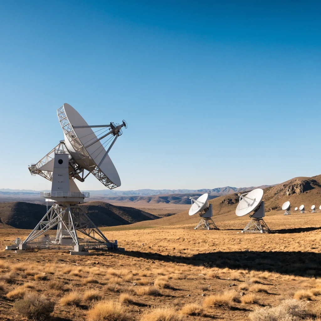
The Very Large Array is an interferometric facility whose antennas sample spatial information at many baseline lengths. Its movable configurations permit different balances between resolution and sensitivity to extended structure. A modern survey can exploit this flexibility through careful configuration choices, mosaicking, wide bandwidths, sophisticated calibration, and imaging methods that preserve information across a large field.
The decisive change is strategic rather than simplistic. Instead of treating resolution and coverage as mutually exclusive headline numbers, survey designers can optimize the entire measurement chain. They can distribute pointings efficiently, use multi-scale deconvolution, account for direction-dependent errors, and combine complementary data products. The survey becomes a coordinated system rather than a sequence of isolated snapshots.
Interferometric Sampling and the uv Plane
An interferometer does not record a conventional photograph. Each pair of antennas measures a Fourier component of the sky brightness, represented by a point in the so-called uv plane. As Earth rotates, projected baselines change and trace tracks through that plane. Better coverage produces a more faithful reconstruction, while missing spatial frequencies can create artefacts or erase structures.
Calculation 2: Consider a radio observation at 1.4 GHz. The wavelength follows from the speed of light divided by frequency: 3.00 × 10⁸ metres per second divided by 1.4 × 10⁹ hertz, or about 0.214 metres. With a 10-kilometre maximum baseline, the nominal resolution is approximately 2.14 × 10⁻⁵ radians, equivalent to about 4.4 arcseconds.
That example exposes why configuration alone cannot define image quality. A long baseline supplies fine spatial sampling, but short baselines remain essential for extended emission. A wide-area survey that combines or balances these scales can identify compact sources without discarding their larger radio halos, lobes, or surrounding diffuse structures. The strongest image is often the one that respects multiple spatial scales simultaneously.
Wideband Imaging, Mosaics, and Calibration
Modern radio receivers observe substantial frequency ranges, improving sensitivity and enabling spectral analysis. Wideband data can reveal whether emission is thermal, synchrotron, aged, absorbed, or influenced by magnetic fields. Multi-frequency synthesis also improves Fourier-plane coverage. Yet bandwidth introduces frequency-dependent beams, changing source structure, and calibration challenges that must be corrected rather than ignored.
A mosaic extends the field by combining many overlapping pointings. Each antenna has a primary beam that limits sensitivity away from its centre, so a carefully designed mosaic prevents abrupt boundaries and uneven noise. Overlap also improves relative calibration. The result is a contiguous sky product whose usefulness depends on uniformity as much as on its total angular extent.
Direction-dependent calibration is particularly important across wide fields. The ionosphere, antenna response, and bright off-axis sources can vary with position. If these effects remain unmodelled, the map develops position-dependent distortions, false sources, or reduced dynamic range. Advanced pipelines therefore calibrate the sky locally where necessary, making high-resolution, wide-area imaging computationally demanding but scientifically credible.
What the Sharper, Broader Map Reveals
A survey becomes transformative when its technical specifications translate into new classes of questions. Higher resolution can separate a galaxy’s compact core from its extended lobes, distinguish multiple components in a merger, or identify a transient embedded in a crowded field. Broad coverage then places those objects within a population, allowing physical interpretation to proceed beyond anecdote.
This combination is especially valuable because radio emission traces processes that optical images often obscure. Synchrotron radiation records relativistic particles and magnetic fields; free-free emission can trace ionized gas; spectral changes can reveal energy losses and activity histories. A detailed radio map across many regions therefore acts as a historical record of energetic events occurring within and between galaxies.
From Blended Sources to Physical Catalogues
Source extraction is not a clerical afterthought. When two objects overlap within a broad beam, their measured fluxes, sizes, and positions can be wrong. Higher resolution improves deblending, but it also raises the burden on calibration and noise modelling. A reliable catalogue must record uncertainties, morphology, spectral behaviour, and the possibility that apparently separate components belong to one physical system.
Calculation 3: Imagine two equal-brightness sources separated by 3 arcseconds. An image with a 6-arcsecond beam is unlikely to distinguish them cleanly, so their combined flux may be catalogued as one object. With a 1.5-arcsecond beam, the separation equals two beam widths. Under favourable signal-to-noise conditions, the pair becomes resolvable, improving both positional measurements and source classification.
That improvement has consequences across astronomy. Cross-matching radio catalogues with optical, infrared, ultraviolet, or X-ray surveys becomes more reliable when radio positions and morphologies are precise. A sharper map can reveal that one optical galaxy hosts a radio jet, while a nearby radio component belongs to a background object. Resolution therefore improves not just images, but the integrity of multi-wavelength science.
Transient Events, Jets, and Diffuse Emission
Wide-area radio monitoring can uncover transient or variable sources whose brief activity would be missed by a narrow, deeply targeted programme. Resolution helps determine whether variability is intrinsic, caused by propagation effects, or associated with a nearby source. Repeated observations can turn a static catalogue into a time-dependent record of the radio universe.
Jets and lobes present the opposite challenge: they can extend across many resolution elements and contain faint, low-surface-brightness structures. Excessive emphasis on sharpness can make these features disappear through incomplete short-spacing information. A scientifically mature survey therefore offers multiple image products, allowing compact-source discovery and diffuse-emission analysis without pretending that one beam is optimal for every target.
Calculation 4: If a survey covers 100 square degrees and detects 50,000 catalogued sources, the mean surface density is 500 sources per square degree. Expanding the footprint to 1,000 square degrees at the same depth would yield approximately 500,000 detections, assuming uniform sensitivity and population statistics. The calculation illustrates why coverage dramatically increases discovery potential.
We Also Published
The Limits, Costs, and Real Meaning of the Advance
Claims of “better resolution without giving up the sky map” require careful interpretation. No survey escapes the radiometer equation, finite observing time, primary-beam attenuation, incomplete baseline coverage, confusion noise, or calibration error. The achievement lies in improving the frontier, not eliminating it. A wider and sharper map may still have variable depth, uneven sensitivity, and different science-ready products.
Readers should also distinguish angular resolution from sensitivity to extended emission. A narrow synthesized beam can make an image look precise while reducing brightness sensitivity to broad structures. Conversely, smoothing a high-resolution image can recover sensitivity to larger features but sacrifice separation. The correct question is not whether one setting wins universally, but whether the survey supplies the right products for distinct scientific tasks.
Noise, Confusion, and Survey Completeness
Thermal noise decreases as collecting time and usable bandwidth increase, but source confusion imposes another limit. At sufficient depth, many faint sources overlap within a beam, creating an irreducible background that complicates detection. Improving resolution generally reduces confusion, which is one reason sharp imaging can extend catalogue completeness even when the raw integration time remains unchanged.
Calculation 5: Suppose the root-mean-square noise in a radio image is 10 microjanskys per beam and a catalogue adopts a five-sigma threshold. The nominal detection limit is 5 × 10 microjanskys, or 50 microjanskys per beam. If improved calibration lowers the noise to 8 microjanskys, the same threshold falls to 40 microjanskys, allowing fainter sources to enter the catalogue.
Completeness is never determined by threshold alone. It depends on source size, morphology, local background, sidelobe structure, and position within the primary beam. A compact source may be detectable at a lower integrated flux than a diffuse source with the same total emission. Survey papers must therefore publish selection functions and reliability estimates rather than presenting raw source counts as self-explanatory facts.
Why the Survey Matters Beyond Its Headline
The deepest value of a wide-area, high-resolution VLA survey is interoperability. Publicly useful imaging, calibrated visibility data, source catalogues, spectral information, and documented uncertainties can support research long after the initial discovery paper. Such infrastructure enables independent analyses, machine-learning classification, targeted follow-up, and comparisons with future facilities operating at different frequencies.
It also changes the economics of discovery. Instead of commissioning separate observations to determine whether a source is compact, extended, variable, or associated with a known galaxy, researchers can begin with a richer baseline dataset. Follow-up time can then be reserved for genuinely ambiguous or scientifically exceptional objects. Survey design becomes a force multiplier for the entire astronomical community.
The strongest conclusion is unapologetically practical: resolution and area should no longer be presented as rival virtues. A carefully engineered radio survey can make them reinforce one another, provided astronomers preserve multiple spatial scales, quantify sensitivity variation, and expose the limitations of reconstruction. The new generation of VLA mapping is important because it turns a familiar compromise into a more productive, information-rich balance.
From our network :
- AI-Powered 'Precision Diagnostic' Replaces Standard GRE Score ReportsDiscover the new GRE Precision Diagnostic. Learn how AI-powered behavioral analytics and time-to-solve tracking are replacing standard GRE score reports to empower students.
- Mastering DB2 LUW v12 Tables: A Comprehensive Technical GuideComprehensive guide on DB2 LUW v12 tables. Explore CREATE TABLE syntax, BLU Acceleration, range partitioning, data types, and security features for IBM DB2 LUW v12.
- Mastering DB2 12.1 Instance Design: A Technical Deep Dive into Modern Database ArchitectureComprehensive guide to DB2 12.1 Instance Design. Explore architectural components, HADR setup, buffer pool tuning, and security policies for IBM DB2 12.1. Includes 10 functional SQL and Shell samples.
- 98% of Global MBA Programs Now Prefer GRE Over GMAT Focus EditionExplore why 98% of global MBA programs now prefer the GRE over GMAT Focus. Learn about the shorter GRE format, verbal logic importance, and strategic versatility for students.
- Analyzing Trump Deportation Numbers Insights Into The 2026 Immigration Crackdown
- 10 Physics Numerical Problems with Solutions for IIT JEEPrepare for IIT JEE with 10 physics numerical problems, complete with detailed solutions and conceptual explanations. Ideal for mastering kinematics, thermodynamics, electromagnetism, and optics.
- Trump Political Strategy How Geopolitical Stunts Serve As Media Diversions
- Vite 6/7 'Cold Start' Regression in Massive Module GraphsIn-depth analysis of Vite 6/7 cold start regressions in massive module graphs. Learn about barrel file issues, pre-bundling optimizations, and how to improve Vite dev server performance.
- EV 2.0: The Solid-State Battery Breakthrough and Global Factory ExpansionDiscover the impact of the Solid-State Battery Breakthrough on the EV market. Learn about CATL and BYD stock growth, global factory expansion in Europe, and the future of EV 2.0 technology.
RESOURCES
- VLA sky survey sets new standard for high-resolution, wide-area ...phys.org2 days ago ... The U.S. National Science Foundation National Radio Astronomy Observatory (NSF NRAO) has completed observations for the Very Large Array Sky ...
- VLASS - National Radio Astronomy Observatorypublic.nrao.eduThe Very Large Array Sky Survey - the invisible universe available to scientists around the world. Learn how to map the sky with radio…
- VLA Sky Survey Sets New Standard for High-Resolution, Wide-Area ...facebook.com3 days ago ... NEW: VLA Sky Survey Sets New Standard for High-Resolution, Wide-Area Radio Astronomy NSF NRAO has completed observations for the Very…
- VLA Sky Survey — NRAO Science Sitescience.nrao.eduAt the May 2013 Radio Astronomy in the LSST Era held at NRAO-Charlottesville many scientists expressed keen interest in employing the VLA to conduct…
- Happy equinox! ☀️ Today everywhere on Earth the day and night ...instagram.comMar 20, 2026 ... VLA Sky Survey (VLASS) Sets New Standard for High-Resolution, Wide-Area Radio Astronomy NSF AUI National Radio Astronomy Observatory NRAO ...
- VLA Sky Survey Sets New Standard for High-Resolution, Wide-Area ...x.com3 days ago ... AAS Press Office (@AAS_Press). 11 likes 735 views. National Radio Astronomy Observatory: Very Large Array Sky Survey Sets New Standard…
- Don't let the perspective fool you! The ngVLA prototype ... - Instagraminstagram.comJun 30, 2026 ... VLA Sky Survey (VLASS) Sets New Standard for High-Resolution, Wide-Area Radio Astronomy NSF AUI National Radio Astronomy Observatory NRAO ...
- NSF NRAO has completed observations for the Very Large Array ...x.com3 days ago ... VLA Sky Survey Sets New Standard for High-Resolution, Wide-Area Radio Astronomy ... radio sky survey ever, mapping 34,000 sq. degrees…
- NVSS - NRAO VLA Sky Survey Catalogheasarc.gsfc.nasa.govThis table contains the National Radio Astronomy Observatory (NRAO) Very Large Array (VLA) Sky Survey, the so-called NVSS Catalog.
- National Radio Astronomy Observatory's Post - LinkedInlinkedin.com3 days ago ... NEW: VLA Sky Survey Sets New Standard for High-Resolution, Wide-Area Radio Astronomy NSF NRAO has completed observations for the Very…


0 Comments